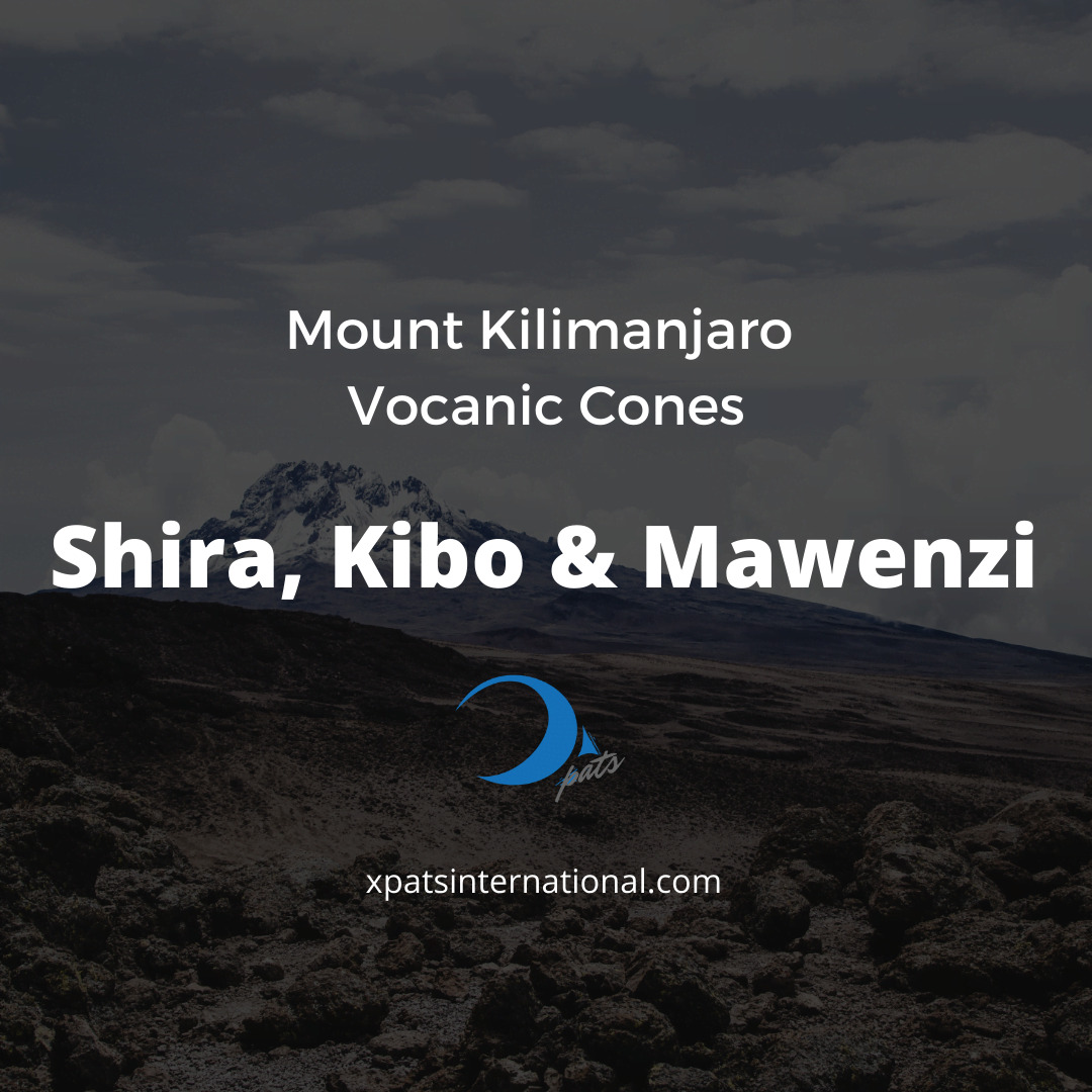
Mount Kilimanjaro comprises three volcanic cones called Mawenzi, Shira, and Kibo, of which only Kibo is considered dormant and could potentially erupt in the future. Mawenzi and Shira are no longer active. Standing at 5,895 meters above sea level, Mount Kilimanjaro is the highest point in Africa, and it is made up of ash, lava, and rock. The last significant eruption occurred approximately 360,000 years ago, while the most recent activity happened about 200 years ago. This article encourages readers to explore the remarkable natural wonder of the three peaks of Mount Kilimanjaro, it’s ecosystems and their relation to other volcanic mountains within the region.
How Many Cones Make Up Mount Kilimanjaro’s Volcano?
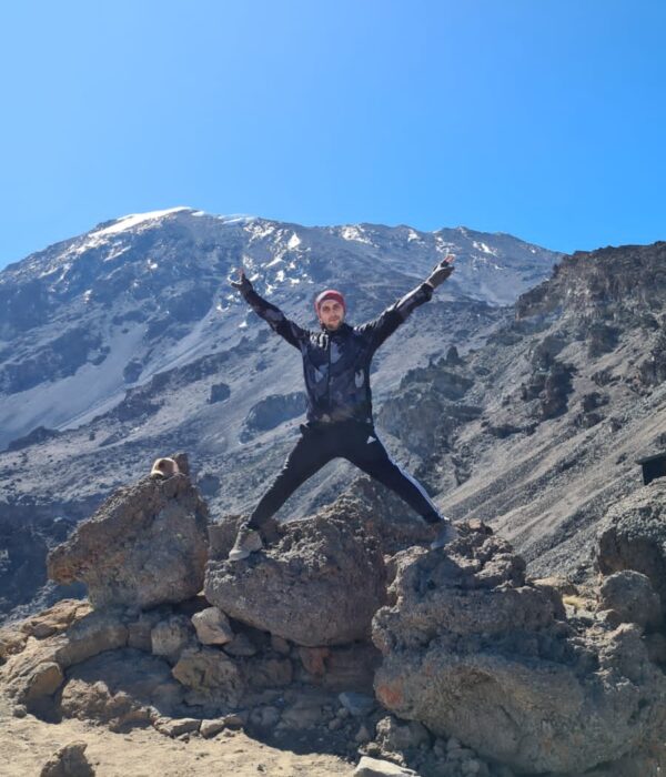
- Kibo Peak—- Kibo, the youngest and tallest of the three cones, is located at the center of Mount Kilimanjaro and reaches a height of 5895m (19341ft) above sea level. It features a snow-covered dome and a 1.2-mile (2-kilometer) wide and 980-foot (300-meter) deep caldera on its southern side. Kibo was created approximately 460,000 years ago and has an inner cone that displays residual volcanic activity.
- Mawenzi Peak —- Mawenzi Peak, the third-highest peak in Africa after Mount Kenya and Kibo, has its highest peak, Hans Meyer Peak, at 5149 meters (16,893 ft). Other notable points on Mawenzi include Purtscheller Peak, Borchers Peak, Klute Peak, Latham Peak, South Peak, Nordecke, and Wissman Peak.
- Shira Peak —- On the other hand, Shira Peak, the smallest peak on Mount Kilimanjaro, is home to several prominent summits, including Johnsell Point at 3962 meters, Klute Peak at 3840 meters, Shira Needle, Shira Cathedral, and East Shira Hill. Despite its size, these summits make up for its lack of height with their prominence.
Seven Summits On Seven Continents
| 7 Summits Ranked | Elevations |
| 🇳🇵 #1. Everest | 8,850m/29,035ft |
| 🇦🇷 #2. Aconcagua | 6,962m/22,829ft |
| 🇺🇸 #3. Denali | 6,190m/20,320ft |
| 🇹🇿 #4. Kilimanjaro | 5,895m/19,340ft |
| 🇷🇺 #5. Elbrus | 5,642m/18,510ft |
| 🏳 #6. Vinson | 4,892m/16,067ft |
| 🇵🇬 #7. Carstensz | 4,884m/16,023ft |
1. The History Of Mount Kilimanjaro As A Stratovolcano In The Great Rift Valley
Mount Kilimanjaro’s formation as a stratovolcano is the result of the interaction between various geological entities and processes in the Great Rift Valley. These include volcanic activity, tectonic plates, rift valleys, plate boundaries, and the East African Rift system, which is a series of rift valleys stretching from Ethiopia to Mozambique. The formation of Mount Kilimanjaro is mainly due to volcanic activity that occurred millions of years ago, resulting in the accumulation of alternating layers of lava, ash, and other volcanic materials that formed the stratovolcano. To better understand Mount Kilimanjaro’s geological formation and its local ecosystem, we need to start with the Afar Triple Junction and its Divergent Plate Boundaries.
Afar Triple Junction & Divergent Plate Boundaries
The Afar Triple Junction, also known as the Afro-Arabian Rift System, is situated at a divergent plate boundary that separates the Nubian, Somali, and Arabian plates. This movement has resulted in significant seismic activity in the area, which may trigger volcanic eruptions or landslides affecting the slopes of Mount Kilimanjaro. However, the Afar Triple Junction’s impact on Mount Kilimanjaro is indirect, and its effects are primarily felt in terms of the tectonic activity in the area. The formation of Mount Kilimanjaro as a stratovolcano is primarily due to the East African Rift system, the Gregory Rift, and other geological features (within the Afar Triple Junction) in the region.
East African Rift System
The East African Rift system, which spans over 3,000 kilometers and resulted from tectonic activity that caused the land to sink, forming a series of valleys and mountains across the east African region, includes Mount Kilimanjaro. One of these valleys is known as the Gregory Rift, named after John Walter Gregory, a British geologist who studied the area in the early 20th century.
Gregory Rift Valley
The Gregory Rift is an active tectonic rift that has impacted Mount Kilimanjaro’s geological processes. The movement and uplift of the Earth’s crust in the area have resulted in the formation of a large magma chamber beneath the mountain. The volcanic activity resulting from the rift has contributed to the formation and alteration of Mount Kilimanjaro’s shape and structure over time. The rift’s intense seismic activity has also caused erosion on the mountain’s slopes, while the geothermal energy resources discovered in the region have contributed to the development of unique ecosystems on Mount Kilimanjaro. This branch of the East African Rift system includes Mount Kilimanjaro, Ngorongoro Crater, Ol Doinyo Lengai, Lake Victoria, and Lake Turkana.
Ol Doinyo Lengai and Shifts in Tectonic Plates
While most of the volcanoes located along the Gregory Rift are either extinct or dormant, Ol Doinyo Lengai remains the only active volcano in the area. The mountain, known for its unique black lava, is situated about 100 kilometers north of Mount Kilimanjaro. Although Ol Doinyo Lengai’s volcanic activity is not known to have a direct impact on Mount Kilimanjaro, the region’s complex geological environment implies potential indirect effects. For instance, the movement of tectonic plates and nearby volcano activities, such as Ol Doinyo Lengai, can generate stress in the Earth’s crust, leading to earthquakes and other geological events. These events may affect the stability of Mount Kilimanjaro’s slopes or the region’s groundwater resources, which are vital for supporting the local ecosystem and communities.
Lake Victoria
Lake Victoria, located 50 miles east of Mount Kilimanjaro, significantly impacts the mountain’s climate and water supply. Moisture-laden winds blowing across the lake from the east contribute to a wetter climate on the windward side of the mountain, resulting in increased rainfall. The rivers and streams originating from Mount Kilimanjaro ultimately flow into Lake Victoria, providing crucial water runoff for the lake’s ecosystem and the surrounding communities. However, the sediment and soil particles carried by these water bodies can contribute to the erosion and sedimentation of the lake’s basin. Furthermore, Lake Victoria is an essential source of water for hydroelectricity generation, supplying power to millions of people in Tanzania, Kenya, and Uganda.
2. Climate Change Is The Primary Cause Of Mount Kilimanjaro’s Glacier Retreat & Sea Level Rises
Significant changes are being caused on Mount Kilimanjaro by climate change, including glacier retreat, reduced snowfall, shifts in vegetation, and water scarcity. Due to global warming, rising temperatures have led to rapid glacier shrinkage, with some predictions suggesting their complete disappearance within the next few decades. Precipitation patterns have been altered, leading to less snowfall, while the warming climate has resulted in vegetation zones being shifted to higher altitudes, putting certain plant species in danger. The melting glaciers on the mountain are having a significant impact on the water supply of millions of people, and these changes are affecting the ecosystem of the mountain and the people who rely on it.
The Melting Ice Cap: Southern and Northern Ice Fields, Glaciers, and Snow Line
The ice cover on Mount Kilimanjaro comprises Snow, Glaciers, Ice Fields, and Kilimanjaro’s Ice Cap. Over the past century, the retreat of the glaciers has been observed on the mountain, resulting in a significant decrease in the size of the ice cover. This retreat is caused by rising temperatures resulting from global warming.
Furtwängler Glacier Retreat
Furtwängler Glacier, located on the northeastern slopes of Mount Kilimanjaro, is one of the mountain’s largest glaciers. However, like many glaciers worldwide, it has been affected by glacier retreat due to climate change. The retreat of this glacier has caused significant changes in the landscape and ecosystem of the mountain. For example, it has created new valleys, exposed more rocks, and changed the water flow patterns of the mountain’s streams and rivers. This has, in turn, affected the flora and fauna that depend on the glacier and its surrounding environment. The retreat of Furtwängler Glacier has therefore had far-reaching impacts on both the natural environment and the human communities relying on the ecosystem services provided by the mountain.
Application of the Greenland Ice Sheet Project to Kilimanjaro’s Ice Cores
The Earth’s ice sheets, including the massive one in Greenland, play a crucial role in regulating the planet’s climate and maintaining the balance of global sea levels. Ice cores, obtained by drilling deep into glaciers or ice sheets, provide valuable tools for investigating the Earth’s climate history. These ice cores contain layers of ice representing many years of accumulated snowfall and can offer information about past climate conditions such as temperature, precipitation, and atmospheric composition. The extracted data can be used to create a timeline of climate changes over hundreds or thousands of years. In the case of Mount Kilimanjaro, ice cores have been used to understand past climate patterns in the region and how they have changed over time. This information is critical for predicting future climate trends and their potential impacts on the environment and human societies.
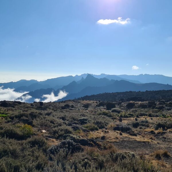
3. The Best Views Of Mount Kilimanjaro Are In Kenya
Despite its location in Tanzania, Mount Kilimanjaro provides some of its most breathtaking views from Kenya. The mountain’s snow-capped peak can be admired from various locations in Kenya, including Amboseli National Park and different points in Nairobi. However, the ultimate pictures of Mount Kilimanjaro from Kenya is undeniably from the Chyulu Hills. This site provides a distinctive perspective that enables visitors to fully appreciate the mountain’s magnitude and magnificence. The sight of Kilimanjaro’s massive presence dominating the skyline is truly awe-inspiring. The contrast between the mountain’s snowy peak and the verdant surroundings creates a natural harmony that is absolutely breathtaking. Those who visit Kenya should not miss the opportunity to witness this extraordinary spectacle for themselves.
Mount Kilimanjaro From Kilimanjaro National Park, Tanzania:
The national park is situated at the base of Mount Kilimanjaro, providing a unique perspective of the mountain. Visitors can witness the snow-capped peak towering above them, while the rugged terrain and diverse vegetation of the mountain are in full view. It is an incredible sight that leaves visitors feeling humbled by the sheer size and beauty of the mountain.
Mount Kilimanjaro From Amboseli National Park, Kenya:
Located in southern Kenya, Amboseli National Park offers a breathtaking view of Mount Kilimanjaro from a distance. The park’s open grasslands, dotted with acacia trees, provide a stunning contrast to the snow-capped peak of the mountain. Visitors can enjoy the sight of elephants, lions, and other wildlife against the backdrop of the majestic mountain.
Mount Kilimanjaro From Tsavo East National Park, Kenya:
Tsavo East National Park, situated in southeastern Kenya, provides a unique perspective of Mount Kilimanjaro from a distance. Visitors can see the snow-capped peak rising above the plains, surrounded by the park’s diverse wildlife and vegetation. The sight of the mountain from Tsavo East is a breathtaking reminder of nature’s raw power and beauty.
Mount Kilimanjaro From Tsavo West National Park, Kenya:
Located on the opposite side of Mount Kilimanjaro, Tsavo West National Park offers a different view of the mountain. Visitors can witness the mountain’s rugged terrain and diverse vegetation, with the snow-capped peak visible in the distance.
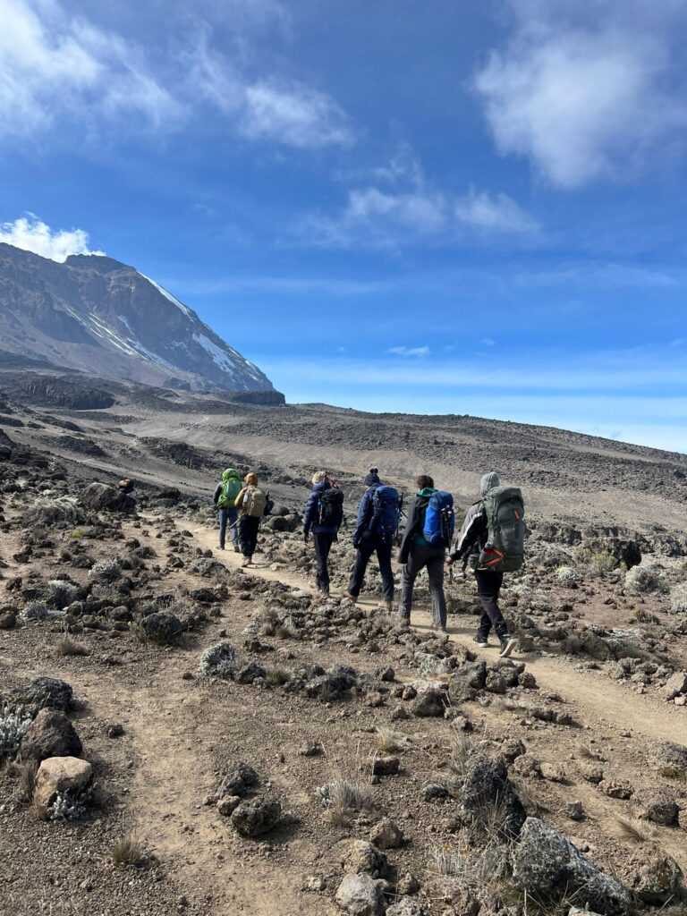
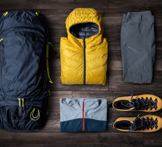
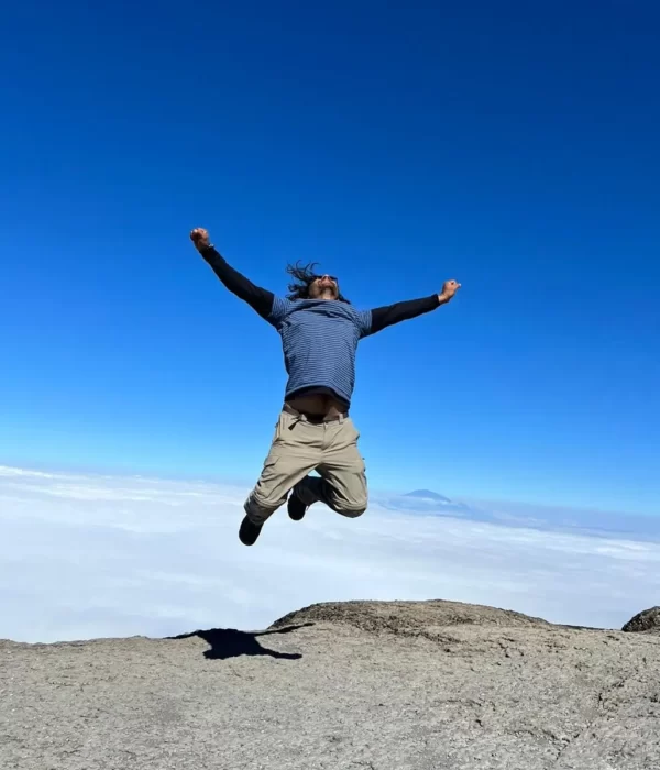
4. Reaching Kilimanjaro’s Summit Is Easier Than You Think
If you want to find the best route to get to Kilimanjaro’s summit, you should compare the Lemosho and Machame routes and then travel to the gate of the one you choose for registration. These two routes are considered the best for hiking Kilimanjaro, among the best Kilimanjaro tour operators, and you are likely to have a much easier experience than with other routes on the mountain. These routes run through the Barranco Valley, which offers stunning views of the mountain and its surroundings. Many first-time hikers above 3,000m (10,000ft) find it difficult to differentiate between the performance of Kilimanjaro vs Everest Base Camp because of these trails. However, unlike the Lemosho and Machame routes, the Marangu route is the only trail that offers budget-friendly programs with hut accommodations. One major drawback of the Marangu route is the low success rate of reaching the summit. Additionally, you will not have the chance to see special wildlife sightings, such as the blue monkeys found on other routes. Regardless of the route you choose, avoid the Western Breach route as an ascent path. This route is well-known for its danger due to random rockfalls that have caused numerous deaths. To successfully complete this climb, you will need technical climbing experience and knowledge of how to prepare for the varying terrains and distances of Kilimanjaro’s routes.

Got questions about this article?
Get free tips from John to jumpstart your Kilimanjaro journey.
Chat with John

