The Machame route is a seven day camping route up Mount Kilimanjaro. The route via Barafu traditionally lasts for six days. The Machame route reaches an altitude of 5,895m, and has elevation gain of about 16,000 to 17,000 feet. Machame route has an ascent of 5,020 metres and a descent of 5,190 metres. The Machame Gate is situated at an elevation of 1,640m. Machame route is deemed challenging due to its elevation gain.
What Are Your Chances of Reaching the Summit of Kilimanjaro?

We've calculated your personalized summit success score, recommended route, and training plan. Enter your details below and we'll send it straight to your inbox.
Enter your details and we'll email your personalized summit success score, recommended route, and training plan.
🔒 No spam. Your details are kept private and never shared.
Check your inbox!
Find your personalized assessment plan.
- What is the Machame Route on Mount Kilimanjaro?
- Is the Machame Route the most popular route on Mount Kilimanjaro?
- What is the length of the Machame Route on Mount Kilimanjaro?
- Can the Machame Route on Mount Kilimanjaro be completed in 7 days?
- What is the itinerary of the Machame Route on Mount Kilimanjaro?
- What is the elevation of the Machame Route on Mount Kilimanjaro?
- What are the camps on the Machame Route on Mount Kilimanjaro?
- What is the scenery like on the Machame Route on Mount Kilimanjaro?
- How difficult is the Machame Route on Mount Kilimanjaro?
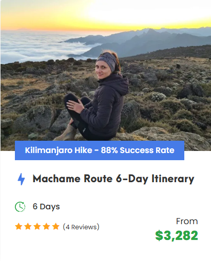
- What is the success rate of the Machame Route on Mount Kilimanjaro?
- What is the price of the Machame Route on Mount Kilimanjaro?
What is the Machame Route on Mount Kilimanjaro?
The Machame route on Mount Kilimanjaro is a six or seven day camping route and is the most popular route on Kilimanjaro. The Machame route is widely deemed to be the most scenic of all of the routes up Mount Kilimanjaro. It is often called the “Whiskey Route”.
The Machame Route is on the southwest of Mount Kilimanjaro. The path starts at Machame Gate, at about one and eight-tenths kilometers of elevation, and goes to the summit, Uhuru Peak, at about five thousand nine hundred meters. It is a 62-kilometer-long trail that is camping-only; climbers on Machame sleep in tents, not in huts. The route typically lasts for six days and five nights, but a 7-day change is the optimal schedule for better acclimatization. It is a route by which to reach Kibo, the highest summit.
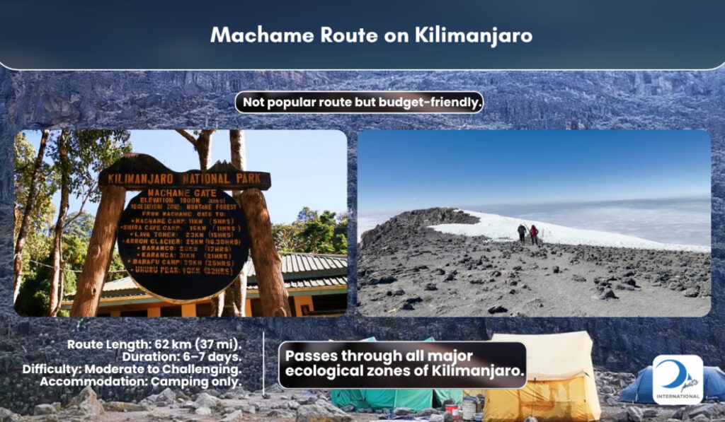
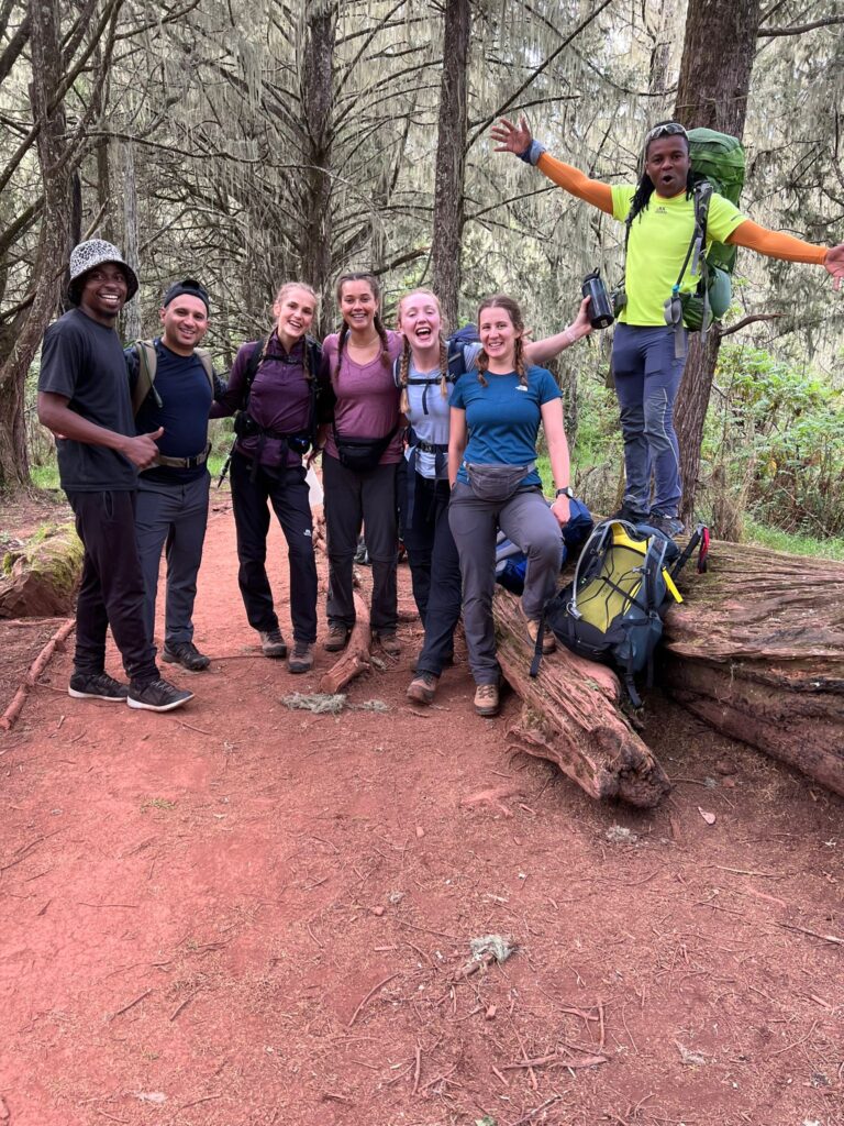
The Machame Route is known for offering some of the most stunning and varied scenery on Mount Kilimanjaro. The trail goes through five weather areas: rainforest, moorland, frigid peak, and high cold dry land. It provides unique and varied landscapes, like the flat land at Shira and the hard volcanic rocks at Fire Rock Tower. The Barranco Wall is a memorable and rewarding moment on the trek-a steep rock scramble about 840 feet (256 meters) high that does not need ropework. The path then leads into the Karanga Valley, and the winding way turns north to approach the summit, striking east below the shadow of Kibo Peak.
The Machame Route has a good acclimatisation profile because of how your body gets used to the altitude. It uses a plan where the ascent goes high and then sleeps low: for example, the ascent leads to Fire Rock Tower at 4,600 meters, then descends to camp at Barranco at 3,950 meters. This allows climbers to acclimatize better. That is why the Machame Route has a high summit success rate, right behind Lemosho. A one-week plan has an 92% chance of reaching the top, while a 6-day trip has an 88% chance.
The Machame Route is the most popular route on Kilimanjaro, used by 35% of all climbers. It is a beautiful and popular route that offers a balance of challenge, scenery, and chance to get used to the altitude. It is a route of choice for many people, including beginners and avid trekkers. The walking is strenuous with hills that go up and down, but guided tours have made it accessible.
Is the Machame Route the most popular route on Mount Kilimanjaro?
Yes, the Machame Route is the most popular route on Mount Kilimanjaro. It accounts for about 35% of all climbers. Approximately 20,000 people climb the Machame route each year. The Machame Route is widely deemed the most scenic route. It has views of the flat highland and the big rock face. The route goes through tropical rainforest, moorland, high cold barren land, and polar peaks, providing a variety of habitats.
Machame Route ascends and descends via different routes. It has gradual ascents and uses climb high, sleep low for excellent acclimatization. The chance of reaching the top is 92% for a 7-day trip. It is right behind the Lemosho Route in terms of the best rate of success. However, it is a tougher climb due to its steepness. The Machame route requires experience backpacking. Most seasoned climbers choose the Machame route.

What is the length of the Machame Route on Mount Kilimanjaro?
The length of the Machame Route differs by source, and overall length changes by itinerary. From gate to gate, the distance is approximately 62 km (38.5 miles). Total walking length is 60.76 km (37.75 miles) from the start of the path to Uhuru Peak and down to the exit point at Mweka. The ascent distance is 40.16 km, or 25 miles, and the descent is 21 km, or 13 miles. A 7-day trek covers 64 kilometres.
Can the Machame Route on Mount Kilimanjaro be completed in 7 days?
Yes, the Machame Route on Mount Kilimanjaro can be completed in seven days. The seven-day itinerary allows for better acclimatisation and has a success rate of 92%. The Machame Route is recommended, and the 7-day Machame Route is a suggested choice. The multiday trek begins from Machame Gate. The route has a distance of more than 38 miles (61.2 kilometers). The route goes through five zones, from rainforest to the freezing top. The Machame Gate has an elevation of about 1.6 kilometers (0.99 miles), and the top of the mountain has an elevation of about 5.9 kilometers (3.67 miles) high.
What is the itinerary of the Machame Route on Mount Kilimanjaro?
The Machame Route itinerary is completed in six or seven days, but the 7-day choice offers better acclimatization and a higher summit success rate, around 92% due to an extra night at Karanga. The standard schedule takes around 7 days and covers approximately 62 km (38 miles), with daily distances and walking times that are well-balanced.
Day 1 takes trekkers from Machame Gate (1,828m) into the rainforest. The first day covers 6.68 miles (10.75 km) and gains 3,970 feet (1210m) in altitude, reaching Machame Hut Camp at about 9,843 feet (3000m), with 5 to 7 hours of walking. Day 2 starts at Machame Camp and ends at Shira Camp. The trek goes steeply up through heathland and moorland, crossing the wide-open Shira Plateau. The day’s walk is about 5 miles (8 km) and the walking time is around 6 hours; the camp sits at about 12,500 feet (3,810m). Day 3 goes from Shira Camp to Barranco Camp via Lava Tower. The route passes through alpine desert, ascends to Lava Tower at 15,092 feet (a junction with the Lemosho route), and then descends to Barranco Camp at 12,959 feet. The distance is around 6.2 miles (10 km) and walking hours are 7 to 9 hours.
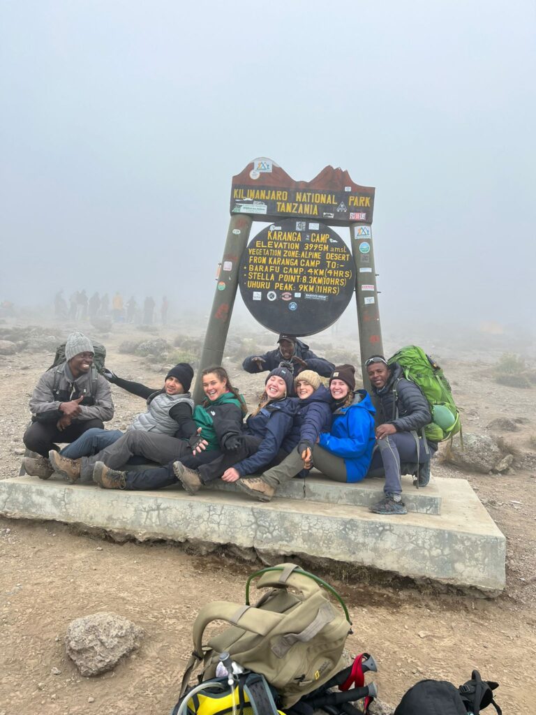
Day 4 involves the Barranco Wall Scramble, a steep rocky climb that is non-technical. The trek then continues to Karanga Camp, a short day of about 5 km (3 miles) and 4 to 5 hours of walking. Karanga Camp is at about 3,995m (13,107ft), and this extra night on the 7-day itinerary allows for better acclimatisation. Day 5 ascends from Karanga Camp to Barafu Camp, crossing highlands with black rocks. The distance is about 3.1 miles (5 km) and walking time is around 5 hours (5 hours). Barafu Camp, at about 4,662m (15,295ft), serves as the base camp before the summit.
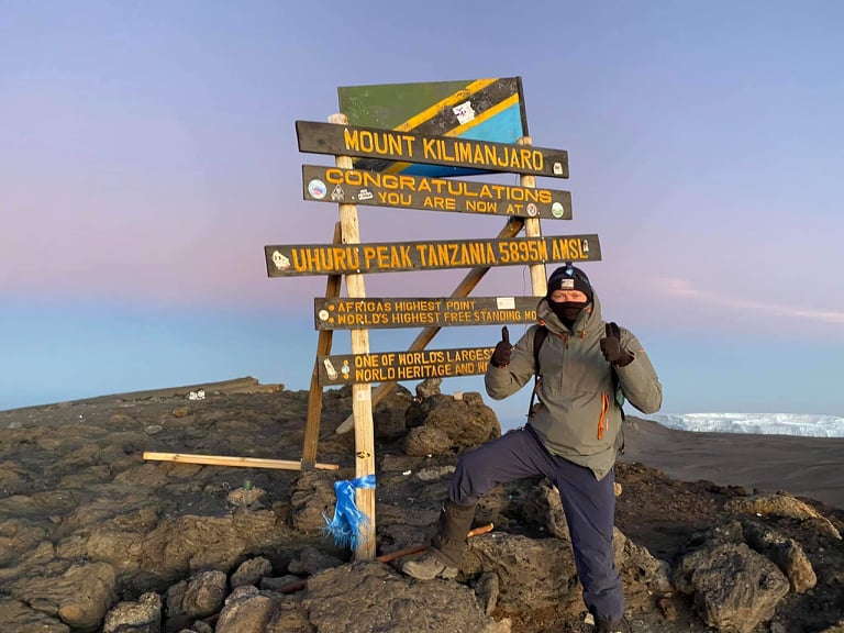
Day 6 is the summit day. Trekkers begin at midnight from Barafu Camp, climbing steeply via Stella Point to Uhuru Peak (5,895m), the top of Mount Kilimanjaro. The climb takes about 7 to 8 hours, and then the route descends to Mweka Camp at 10,171ft (3,100m). The entire day’s walk is around 11 to 14 hours. Day 7 goes from Mweka Camp down to Mweka Gate, passing through the lush rainforest. The descent covers about 8.4 miles (13.5 km) and the walking time is about 5 hours. At the gate, trekkers receive summit certificates.
What is the elevation of the Machame Route on Mount Kilimanjaro?
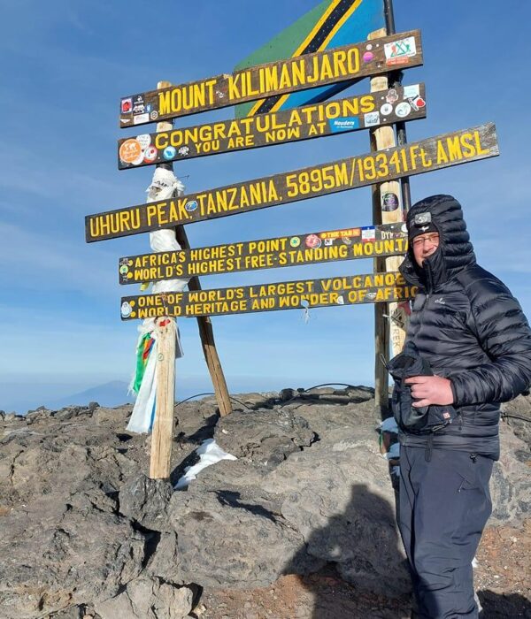
The Machame Route has a total elevation gain of approximately 16,000 to 17,000 feet (4,877 to 5,182 meters). Ascent is 16,569 feet (5050 meters). The Machame Route starts at Machame Gate that has an elevation of 1,640 meters. Machame park’s entrance gate has an elevation of 5,380 feet (1,640 meters). Uhuru peak stands at 5,895 metres (19340.55 feet) above sea level. The Machame route reaches a height of 19,341 feet (5,895 meters), which is the summit.
What are the camps on the Machame Route on Mount Kilimanjaro?
The Machame Route on Mount Kilimanjaro includes designated campsites. These camps are rest points that facilitate proper acclimatization. The route does not have huts; instead, trekkers sleep in tents. Machame Gate is the entry point, located on the southwest near a village. Its altitude is 5,380 feet (1,790 metres). From Machame Gate, the trek to Machame Camp covers about 11 kilometers (7 miles), a gradual climb that takes half a day.
Machame Camp sits in montane forest vegetation at an elevation of 2,820 metres (9,252 feet). From there, the next camp is Shira Camp 2, which is located on the Shira Plateau and has an altitude of 3,850 metres (12,631 feet). Day Three moves to Barranco Camp, which is situated below the Barranco Wall and offers scenic views. Its elevation is 3,900 metres (12795.3 feet). The route then reaches Karanga Camp, a rest and regroup point, at an altitude of about 3,950 metres (about 12,959 feet). On Day Five, trekkers arrive at Barafu Camp. This camp is perched on a rocky ridge at 4,670 metres (15,321.5 feet) and serves as the base camp for summit attempts.
After the summit push, climbers descend to Millennium Camp, which has an elevation of 3,800 metres (12,467 feet). The final overnight before the exit is Mweka Camp, at 3,100 metres (10,170 feet). The Machame Route offers options like Kosovo Camp, an exclusive high camp at over 16,000 feet (4877 meters). All these camps are set up by helpers who put up tents and prepare meals.
What is the scenery like on the Machame Route on Mount Kilimanjaro?
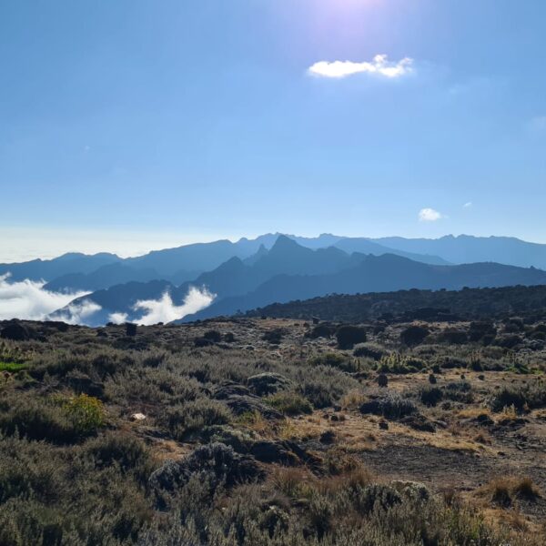
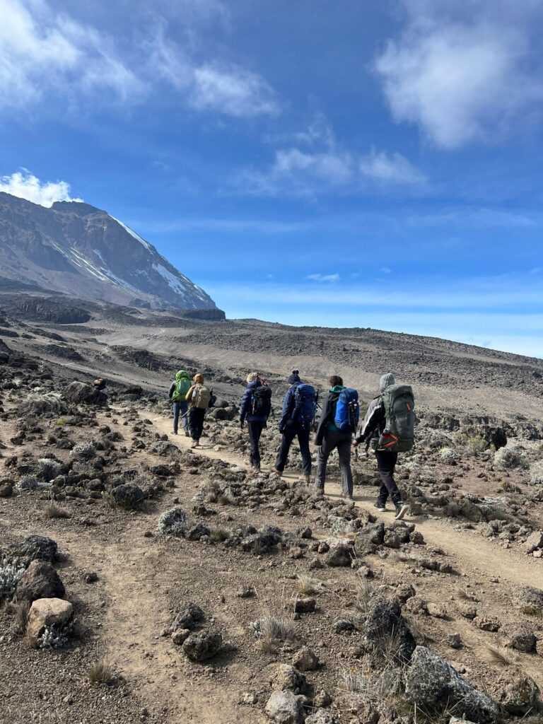
The scenery on the Machame Route is widely deemed to be the most scenic of all of the routes up Mount Kilimanjaro. The route passes through five distinct zones. The scenery is extremely varied, from verdant rainforest to the freezing arctic world of the summit. The transformation feels like traversing different worlds, because the diverse landscapes include forests, the Shira Plateau, wild grasslands dotted with giant heathers, stark lava formations, and the barren alpine desert before the glacial zone. Highlights like Barranco Wall and Lava Tower add vistas, which is why the route is a favorite among photographers.
The forest on the Machame Route is a dense forest. This forest has towering trees draped with moss and vines, and it also has dense underbrush, tree ferns, and dangling lichen. The trees are complemented by streams and flowers like Kilimanjaro Impatiens and Gladiolus Watsonioides. Colobus monkeys and blue monkeys appear in the canopy, and views are frequently veiled by thick clouds, which adds to the magical feel of the rainforest. The forest gradually opens up, giving way to the moorland zone, and that is when the scenery transforms again into more varied and beautiful landscapes.
How difficult is the Machame Route on Mount Kilimanjaro?
The Machame Route is deemed a moderately difficult trek. The trail is challenging and steep, with elevation changes. The route has a steeper profile, which is harder to handle. The route covers about 62 kilometers (38.5 miles) over nearly a week. Daily distances include 9.3 kilometers (5.78 miles), and the trek goes up in height substantially. The Machame Route goes up in the first two days, using walk-high sleep-low principles for acclimatization. However, the rainforest sections are steep and slippery, and the trail is muddy. The Barranco Wall adds an endurance test, where you use your hands to climb. The final summit climb begins at midnight, with continuous walking all night and half a day, climbing 1,200 meters (3,937 feet) elevation. This intensity is the highest, and hikers feel signs of strain. The Machame Route needs stamina and strong legs, but no technical expertise.
Acclimatization is the deciding factor for the summit. Longer itineraries increase the chance of reaching the summit. The seven-day Machame Route is the recommended version, with a summit success rate around 92%. The six-day itinerary has a success rate around 88%. Overnight at Karanga camp allows better recovery and more time for acclimatization, which helps manage the difficulty. Due to the walk-high sleep-low profile, the Machame Route allows for adequate acclimatisation. So the Machame Route level is difficult, but it is manageable for adventurous trekkers. The challenge is significant, especially during the final ascent and in steep sections, but it is doable for first-time backpackers, though those with high altitude experience will be better suited.
What is the success rate of the Machame Route on Mount Kilimanjaro?
The success rate of the Machame Route ranges from 88% on 6-day treks to 92% on 7-day Pole-Pole itinerary.
What is the price of the Machame Route on Mount Kilimanjaro?
The price of the Machame Route on Mount Kilimanjaro varies. The Machame route cost ranges from $3000 to $6000, and price varies depending on length of trek, operator, and number of clients. The 5 day route is the cheapest.
The 6 Day Machame Route costs around $3000 to $3600. Solo trips cost around $4781. For a 7-day trek, the cost is around $4981 per person. A group trek costs around $3375. The cheapest package costs $3000.

Got questions about this post?
Get free tips from John to help jumpstart your Kilimanjaro journey! Whether securing a travel visa or finding your ideal tourist destination to navigating through a list full of travel insurance policies, John will help you figure out the local tourism industry.
Chat with John